Local History
The origins of Charlotteville are detailed in "Guildford" by E.R. Chamberlin (Phillimore and Co. Ltd 1982)
The following details are based on the Chamberlin's account.
In 1862, Thomas Jenner Sells, a Guildford doctor, purchased a large plot of land at the south-eastern end of Guildford with the idea of creating a major housing estate. As was common practice at the time wealthy gentlemen would purchase a plot of land and have a villa built for themselves. At the same time they would commission 20-30 artisan's cottages. The rent from the cottages would then subsidise the cost of the villa. Thomas Sells seems to have acted as the entrepreneur go-between to facilitate the deal between the original land-owner and the purchaser.
To plan the layout of the roads and the necessary infrastructure, Thomas Sells worked with Henry Peak, the town's first Borough surveyor, and the design for one of the first housing estates in the town took shape. Two parallel roads Sydenham Road and Harvey Road were linked by a series of smaller roads such as Bright Hill and Cheselden and Jenner Road. South of Harvey Road, Addison, Chesham and Bailie Road linked up with Cooper and Cline Road. The whole estate covered an area as large as the town centre itself.
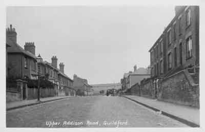
Upper Addison Road. From the David Rose Collection. Reproduced by permission of David Rose.
Thomas Sells named the area after his wife, Charlotte, and all the roads were named after famous physicians. For example Addison after Thomas Addison a famous 19th-century physician at Guy's Hospital, Cline after the famous surgeon Henry Cline and Cooper Road after Astley Cooper surgeon to George IV, William IV and Queen Victoria.
A range of houses were constructed in the 1880's onwards mixing medium-sized villas with terraced cottages for skilled artisans. The 1901 Census reveals upholsterer's, french polishers, whitesmith's and gardener's amongst the inhabitants of Cline, Cooper and Addison Road, compared to the residents of Harvey Road who had live-in servants and were "living off their own means" or were shop owners and managers.
Many shops featured in these roads and there were also several Public houses.
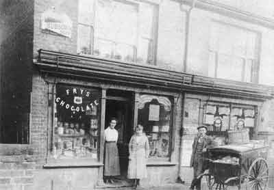
Pennifold's Bakery and Confectionery, No. 24, Addison Road circa 1890-1910. Originally published by H. Williams of Guildford, taken from Memory Lane Guildford & District by David Rose (Breedon Books 2000). Reproduced with permission of David Rose.
An article found in the scrapbooks of the Guildford Institute suggests the first house in Charlotteville was built close to the corner of Addison and Harvey Road. See image below. It was built by Mr W. Burdett for Mr G. H. Simmonds, High Street, Guildford. In 1871 Census, 1, Cooper Road (re-named Addison Road sometime later)was occupied by Henry Simmonds, draper. The house is called Claude Villa. The article in the scrapbook says the house is named Addison House and is occupied by Dr Allan Pimm, but no date is given.
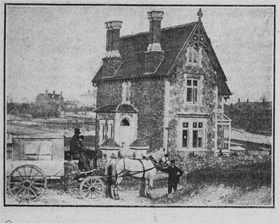
First House in Charlotteville. Source unknown. Reproduced by permission of the Guildford Institute
The buildings in the background are reported to be those of the Union workhouse.
In 1895, a chapel constructed of green corrugated iron, and known as the "tin-tabernacle" was constructed in Addison Road.
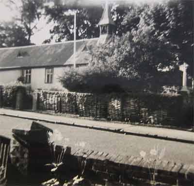
St. Lukes Church, c. 1964. Reproduced by permission of Surrey History Centre
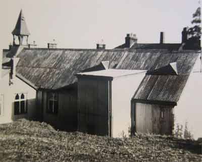
St. Lukes Church, c. 1964. Reproduced by permission of Surrey History Centre
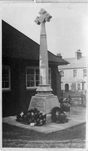
Memorial in original position. Reproduced by permission of Mrs. Mabel Dowling
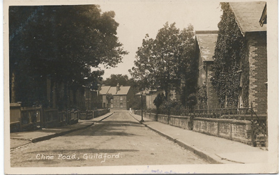
Cline Road circa 1912. From a postcard in the David Rose Collection. Reproduced with permission of David Rose.
The image above featured on www.guildford-dragon.com as one of David Rose's Through Time, weekly Where is This competition. An excellent web-site for keeping up with local news and history. For comparison I recently took the same view below.
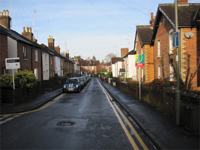
Cline Road today
More houses were built in the early 1900's and included Guildford's first "Council" houses in Cline Road
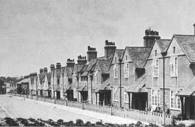
Cline Road circa 1906. Originally published by H. Williams of Guildford, taken from Memory Lane Guildford & District by David Rose (Breedon Books 2000). Reproduced with permission of David Rose.
During World War II Guildford was a key location on the line of man-made and natural defences between the south coast and London, known as the GHQ Line. The history of the GHQ stop line is well researched and documented on other web-sites.
Close to Charlotteville is London Road station. The station was protected by tank-traps and a trench system running parallel to the railway. St Lukes was by now a military hospital and half a mile away on the Merrow Downs there was a Prisoner-of-War camp for Italian prisoners. The area could have been a potential target for enemy bombers although it is believed the bombs that caused the damage in Addison and Cline Road in 1941 were probably dropped by mistake. See Roll of Honour page for Herbert Walter Washington
Residents were encouraged to build Anderson shelters in their gardens. Basic shelters comprising corrugated sheets of iron covered in earth. More substantial brick and concrete shelters were also constructed. The remains of one, now sealed off, lie buried behind gardens on the North side of Cline Road. A similar above ground shelter is still in use in Baillie Road.
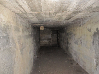
Air Raid Shelter, Baillie Road
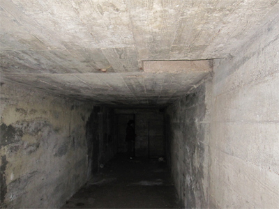
Air Raid Shelter, Baillie Road